Pull out the stops on remote sensing for small scale storage in the Western Sahel
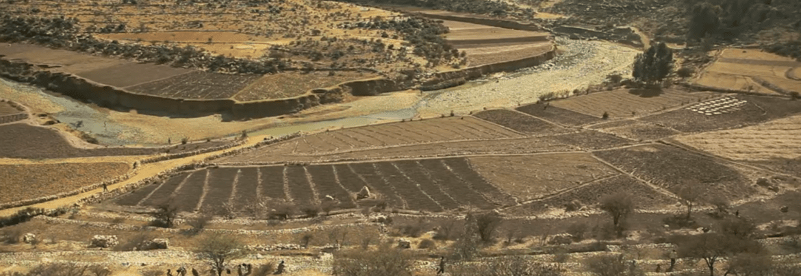
The western Sahel is drying up, degrading and arable land is getting scarce. Yet, every year, water from arid upstream lands of the western Sahel causes downstream floods. In other areas large dams leave people downstream without water. This situation raises several questions, where are these areas with excess water? Where and during what period of the year should water be allowed to flow? How can we know where to store water even though we cannot get into the field?
In a consortium led by AidEnvironment, seven organizations* are working on a unique assignment for the World Bank, looking at the river basins flowing from the western Sahel and the opportunities to harvest water. A unique opportunity to take a bird’s eye view on such a large area and come up with implementable options and solutions. Time is short, budgets are small, and there is much work to be done.


Each year Wageningen University organizes an Academic Consultancy Training. Students from the master Climate Studies and Earth and Environment get the chance put their education in practice by doing a project for a real customer, focusing on climate adaptation and mitigation. Providing a perfect match for this assignment, where many people are needed to look at the different catchments of the western Sahel. With Acacia Water, AidEnvironment requested a group of 6 students to pull out the stops on remote sensing in the western Sahel. Every kind of information they can muster is useful, water balance, case studies, area definition, historical satellite image analysis, etc.
Having the students join and assist with data collection is a great addition to this project. It makes the project much more interesting and comprehensive. Simultaneously, it gives the students a taste of these comprehensive kinds of assignments and raise their interest for the work in water sustainability.
For more information, please contact Maarten Onneweer