Severe flooding in Indonesia impacted by deforestation
Written by Erliza Cikal Arthalina
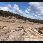
Over the past few weeks, several regions across Sumatra—particularly Aceh, North Sumatra, and West Sumatra—have experienced severe floods and landslides. Extreme rainfall associated with La Niña and Cyclone Senyar in the Strait of Malacca inundated landscapes that have long become more fragile due to reduced standing forest. In many locations, the combination of these factors led to rapid water flows and landslides that severely affected hundreds of villages.
As of December 15, the death toll has surpassed 1,000. Almost one million residents have been displaced, and more than 28,000 homes were damaged or destroyed. Provincial officials in Aceh note that the extent of damage in some areas is comparable to the post-2004 tsunami landscape. Several days after the event, access to food, clean water, and medical services remained limited in the affected region.
Amid deep grief for the lives lost, concern is also rising over the long-standing risks of deforestation, largely driven by land-use conversion. The connections between deforestation and the impact of devastating climate events are becoming more and more apparent. Large logs found along flood paths indicate the scale of deforestation upstream. This situation exemplifies that natural protection no longer works if it is continuously compromised by palm oil concessions, logging, mining, and other land use changes.
The Indonesian government stated that deforestation in Indonesia has decreased throughout 2025 compared to 2024, yet the cumulative impact of decades of bad practice have clear, tragic effects on the population today. According to MapBiomas Landy, more than three decades ago Sumatra had approximately 17.9 million hectares of forest formations, which declined by roughly 30% to 12.6 million hectares by 2024. When calculated on a daily basis, forest loss in the disaster-affected areas of Aceh, North Sumatra, and West Sumatra amounts to nearly 100 hectares per day, equivalent to the loss of approximately 139 football fields every day. When calculated annually, this forest loss is equivalent to losing an area the size of Malta each year.
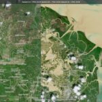
One of the districts most severely affected by flooding is Aceh Tamiang, which occupies 2,216.16 km². Located on the eastern coast of the province bordering the Malacca Strait, this district is dominated by palm oil plantations, leaving only 576 km² of forest remaining, less than a quarter of its total area. Changes in the landscape of downstream Aceh Tamiang before and after the floods can be observed satellite imagery, including the mosaic of plantations that now shape the region’s hydrological dynamics.
While discussions on the causes of the disaster continue, there has not yet been any official indication of responsibility from major concession holders. Likewise, formal statements have not directly addressed how changes in upstream forest cover may have influenced the severity of impacts downstream. These developments highlight the importance of reviewing long-term land-use trends and policy decisions, because environmental conditions shaped over many years play a role in how landscapes respond to extreme weather events, now and well into the future.
As communities continue to cope with displacement, destruction, and limited access to basic services, there is an urgent need to take a deeper look at the confluence of deforestation and other factors exacerbating the impacts of climate change and weather events.
The situation remains critical, and better management of and protection of natural resources is paramount.
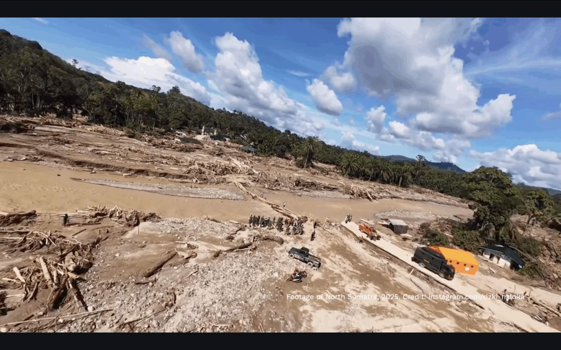
Drone video showing the condition of Garoga Village in South Tapanuli, North Sumatra, after the flood. Credit: footage from instagram.com/rizki_haloka; audio from canva music.