What is the Water Potential Estimator (WPE) tool?
Article drafted by Niels Lenderink, Senior Programme Manager
A consortium involving Meta Meta Research, CDE at University of Bern (WOCAT), Acacia Water and AidEnvironment, funded by the World Bank, is developing the Water Potential Estimator (WPE).
The WPE is the second in the series of online tools developed by the consortium. The first one is the Water Harvesting Explorer (WHE), which assists the user to explore the opportunities for small scale water harvesting and water storage in the landscapes of the Western Sahel. The site provides basic information to get the user started with water management planning and has been developed using publicly available data. The WHE started with the Western Sahel (https://sahel.acaciadata.com/) and has recently been extended to East Africa (https://whe.acaciadata.com/).
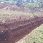
The second, most recent tool, that is being developed now, is called the Water Potential Estimator (WPE). This tool calculates the potential extra water that could be stored in an area, once water harvesting measures (as suggested by the WHE) and/or land use changes will have been implemented. The tool is based on the curve number method, which quantifies the relationship between rainfall and runoff, taking into account various parameters such as land use, soil type, and land management practices.
The WPE is based on the Sustainable Land Management (SLM) watershed tool as developed and tested by consortium member WOCAT, and uses the curve number method in an interactive and user-friendly environment to visualize the effect of land cover and runoff management on local water flows, using three possible scenarios. It will come with documentation, multilingual support, and a training package.