Government, partners intensify restoration activities in disaster-prone Elgon area
By Javier Silas Omagor
In a collaborative effort, the government through the ministry of water and environment, (MWE), along with partners such as World Bank and AidEnvironment has ramped up restoration activities in a disaster-prone Mt. Elgon area to enhance resilience and mitigate the impact of future calamities.
This was revealed on December, Saturday, 16, at the well-attended ceremony to launch the Riverbank demarcation and restoration activities at Baptist Church, Bulosi village, Munamba town board, Bututu sub county in Namisindwa district.
The disaster-prone region, known for its vulnerability to natural disasters such as landslides, floods, waterlogging, and prolonged drought has prompted a proactive response from local authorities and non-governmental organizations (NGOs).
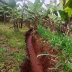
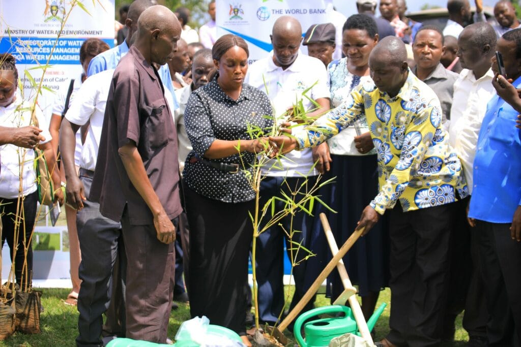
To do this, the government has opted for the comprehensive restoration initiative dubbed Lwakhakha Integrated Water Management and Development Project (IMWDP). The two-year Lwakhakha IMWDP (2022-2024) is supporting communities to implement catchment measures including soil and water conservation, afforestation, reforestation, riverbank protection and providing alternative livelihoods for affected communities.
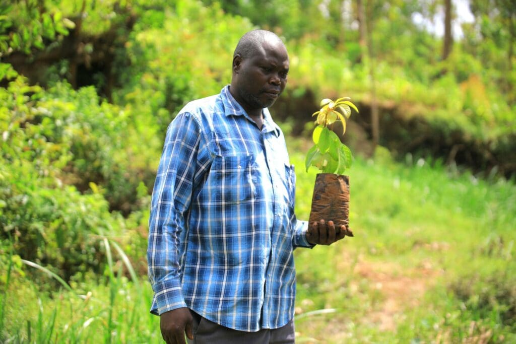
To control erosion and siltation, the project is aiming at rehabilitating 6.73 kilometer stretch of gullies in the districts of Namindwa, Manafwa and Tororo. The government also expects to ensure that up to 72 km (36km on each side) of degraded stretches of rivers in Lwakhakha are restored through the project.
In order to protect water sources across the area, the activity is to work with communities in the sub-catchment to maintain and improve the quality of the local water environment. Water source protection measures are to facilitate infiltration, control groundwater pollution, reduce siltation and improve discharge.
The Lwakhakha IMWDP is implemented by the Ministry of Water &Environment (MWE) through its partner AidEnvironment with funding from the World Bank, supervised by the International Union for Conservation of Nature (IUCN).
According to Haggai Ojwang, the water officer at the MWE attached to Kyoga Water management Zone, the initiative will produce imminent impact. “We are here today to start the process of riverbank demarcation and restoration. Already the communities have been sensitized and empowered on doing riverbank demarcation and restoration,” Ojwang said.
Ojwang continued: “It is also in our activity work plan to introduce alternative income generating activities for these affected communities who have been reliant on these riverbanks.” Some of the activities we are fronting for alternative incoming generation for the affected communities include beekeeping, agroforestry, commercial bamboo farming and fishing ponds among others.
“Going forward, we trust this intervention will instill ownership of these community driven conservation activities into our people in Elgon sub region, Tororo and the entire country for us to bolster the country’s effort to combat climate change,”Ogwang said.
In her community exposure experience, Esther Apio, the community development officer (CDO) Kalait sub county in Tororo district admittedly acknowledged that the residents along Kodike river who are beneficiaries of the government project were willing to embrace and sustain it.
“Most of them are farmers who have in one way, or the other encountered losses caused by climate change’s negative effects,” Apio noted, “so more than ever, our local communities know that any ecosystem restoration activities are a must compliance.”
Having spent all his lifetime in Kalait this far, the 67-year-old Richard Jerom Opidi is thrilled and expects the initiative to restore the lost admirable green cover and entire rich ecosystem. “Before we unknowingly degraded our environment, Kalait village was like a garden of Eden. It was fresh and abundantly wealthy in safe and clean water, food and all these things you could imagine but today, this village is a shadow of itself,” Opidi recounted. The aging Opidi strongly believes in the ongoing government initiative; “because once implemented well, all this lost environmental glory can easily be recovered and that potentially improves our livelihoods.”
In Manafwa district, Andrew Wenani, the mayor of Bunyinza town council, said given the fact that the project is wholly owned by his community who desire to combat climate change variations in their area. “All we ask for is the extension of this initiative’s timeline which is expiring in February 2024, a time which is not enough for proper mindset to be impacted in our community,” Wenani said.
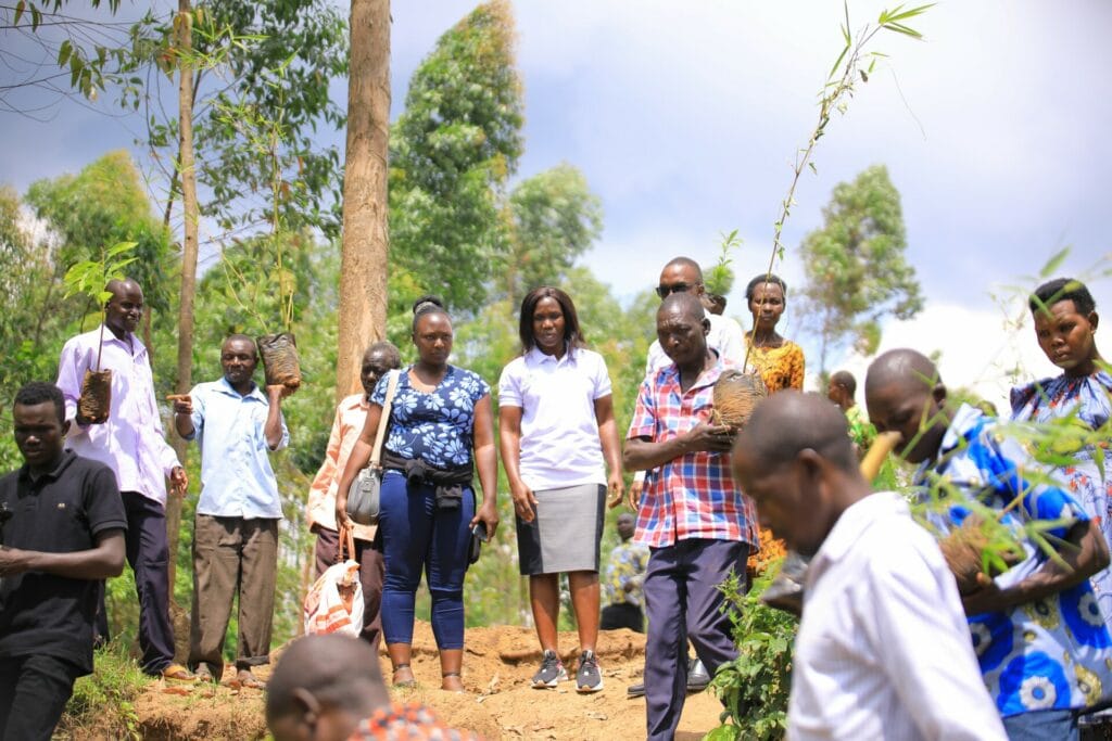
Indeed, the initiative is community driven, putting communities at the center of managing their catchment which ensures sustainability and scales up interventions. “Considering the consequences of inaction towards restoration and failure to observe good environmental practices, residents have quickly understood the need for them to own the initiative,” Raymond Tumuhaire the AidEnviornment Project Manager said. Given the community’s positive attitude, Tumuhaire expressed contentment in the sustainability of the conservative activities being implemented in the area. For the technical support during the riverbank demarcation, the national environment and management authority (NEMA) officials led by Esther Okisol, the senior environment assessment officer demonstrated to the taskforce and community members how the measurements are taken.
Juliet Solome Namara, the deputy resident district commissioner (D. RDC) Namisindwa commended the government in coordination with partners for prioritizing disaster risk reduction and management interventions before lauding the residents for “hugely and passionately embracing the project.” “Each community will have at least two technical persons from our office (NEMA) helping them demarcate the streams, rivers and other watersheds therein,” Okisol said. NEMA recommends communities to spare 100 meters of land from the streams and small rivers while a distance of 200 meters from the main lakes is required.